Kamen Bryag (Roussalka)
Kamen Bryag is a village in northeastern Bulgaria.
It is located in Kavarna Municipality, Dobrich Province, on the Black Sea coast. The population was 76 in 2009.
Yailata National Archaeological Reserve is located two kilometers south of the village.
Old names
Kamennik - Medieval, not sufficiently confirmed.
Kaya Bey Kyo - by the Ottoman authorities - literally translated "The Village of the Stone Master". The name of the village originates from the lone rock in front of the Little Egg on the seashore in front of the village, symbolizing its location, as well as in general the rocky coast about kilometers high, not less than 30 meters high. In the area is also the Yaylata locality, which is a huge stone formation.
Stânca - during the Roman rule of 1919–1940.
Only Bulgarians live in Kamen Bryag, some of whom are descendants of immigrants from the Balkans (Kotlensko and Elensko), and another part - descendants of immigrants from Romania - who came in the early 1940s as a result of the Craiova Agreement. Like most villages in the area, the elderly population before the migration of Balkanis belongs to the Gagauz ethnographic group.
Map - Kamen Bryag (Roussalka)
Map
Country - Bulgaria
 |
 |
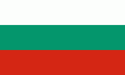
| Flag of Bulgaria | |
One of the earliest societies in the lands of modern-day Bulgaria was the Neolithic Karanovo culture, which dates back to 6,500 BC. In the 6th to 3rd century BC the region was a battleground for ancient Thracians, Persians, Celts and Macedonians; stability came when the Roman Empire conquered the region in AD 45. After the Roman state splintered, tribal invasions in the region resumed. Around the 6th century, these territories were settled by the early Slavs. The Bulgars, led by Asparuh, attacked from the lands of Old Great Bulgaria and permanently invaded the Balkans in the late 7th century. They established the First Bulgarian Empire, victoriously recognised by treaty in 681 AD by the Eastern Roman Empire. It dominated most of the Balkans and significantly influenced Slavic cultures by developing the Cyrillic script. The First Bulgarian Empire lasted until the early 11th century, when Byzantine emperor Basil II conquered and dismantled it. A successful Bulgarian revolt in 1185 established a Second Bulgarian Empire, which reached its apex under Ivan Asen II (1218–1241). After numerous exhausting wars and feudal strife, the empire disintegrated and in 1396 fell under Ottoman rule for nearly five centuries.
Currency / Language
| ISO | Currency | Symbol | Significant figures |
|---|---|---|---|
| BGN | Bulgarian lev | лв | 2 |
| ISO | Language |
|---|---|
| BG | Bulgarian language |
| TR | Turkish language |


